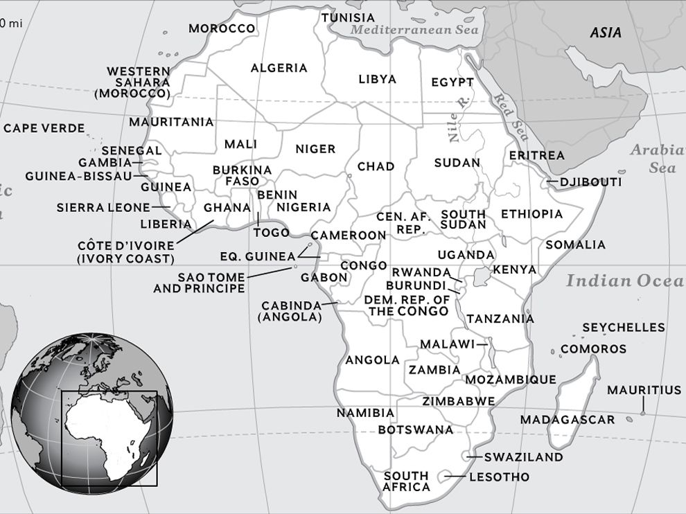
Map of AfricaThe continent of Africa is the second largest continent in the world, made up of 54 independent countries, each with its own government and a blend of cultures, languages and rich history
Click to on this Map of Africa to enlarge
List of Africa's Sovereign States
The Republic of Somaliland and the Sahrawi Arab Democratic Republic are two states which have established themselves but have limited recognition elsewhere in the world. Africa's non-sovereign states include the Canary Islands, Ceuta, French Southern and Antarctic Lands, Lampedusa and Lampione,Madeira, Mayotte, Melilla, Plazaz de soberania, Réunion, Saint Helena Ascension and Tristan da Cunha. The political boundaries in the map below will give you an idea of the many states and where they are positioned. Map of Africa's ClimatesAfrica has a mixture of different climates which are very much dependent on rainfall. The climate zones include:
Climates of Africa
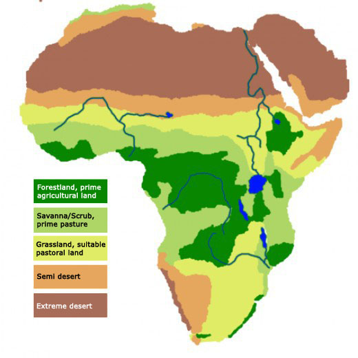
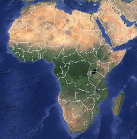
Map of Africa's VegetationThe vegetation in Africa very much depends on the climate and rainfall patterns, more specifically - heat and moisture. You can see this when you compare the satellite map below with the climate map above.
Satellite map showing Africa's vegetation density
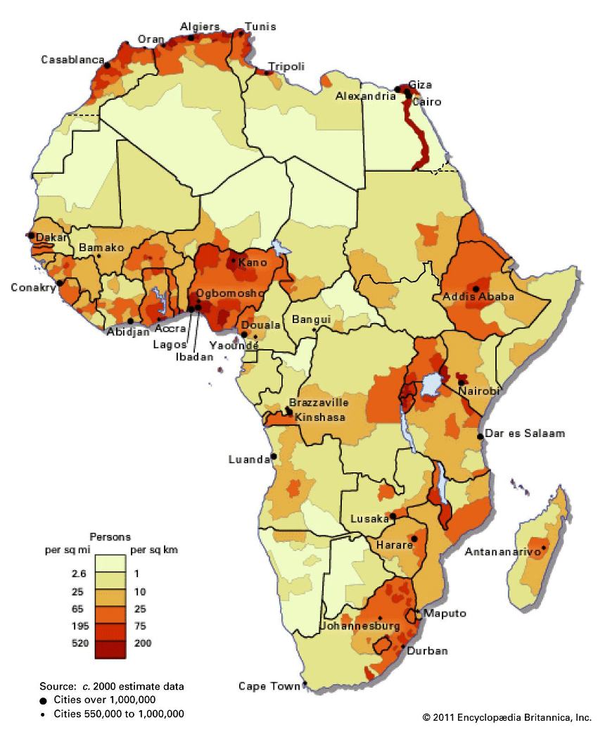
South of the coast and the Atlas mountains lies the Sahara region, which is the large light coloured area in the map above. The desert has plants which have adapted to very dry climate such as the date palm. Entering the semi-desert area, we find plenty of the acacia variety. Further south lies the more humid regions with tropical woodlands and savannah grasslands, to dense evergreen tropical forest such as those found in West Africa and the Equatorial region. Below the Equator, the vegetation goes from thick tropical forests to more savannah bush and grasslands, to semi-desert and desert. Along the eastern part of the African continent, we find a few highlands (especially below the "horn of Africa"), which are characterised by similar vegetation to that of the eastern Mediterranean mountains, the Himalaya and Indo-China. Map of Africa's Population DensityThe population density of an area is the number of people living per square kilometre of that area, i.e. inhabitants/km2. Africa's population density is shown below.
Africa's Population Density Here is a song about the countries of Africa: For all sorts of different Maps of Africa try this link...
Other sites with African maps: Click on the links below for detailed information on these topics relating specifically to Africa...

Return from Map of Africa to our home page
|
Follow!
  
|
|||||||||||||||||||||||||||||||||||||||||||||||||||||||||
|
|
||||||||||||||||||||||||||||||||||||||||||||||||||||||||||
|
|
||||||||||||||||||||||||||||||||||||||||||||||||||||||||||
|
| ||||||||||||||||||||||||||||||||||||||||||||||||||||||||||